Introduction
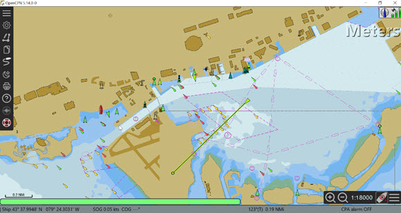
In the previous post I looked at receiving AIS on OpenCPN using the latest ECN charts for the Montreal harbour (Ref.1). Since 2017 I have been using Raster BSB charts. In this post I compare various chart formats such as Paper, Raster BSB and ENC. ENC charts are vector charts and contain a wealth of information. By right clicking on any feature you can “Object Query” information about the object.
Equipment Block Diagram
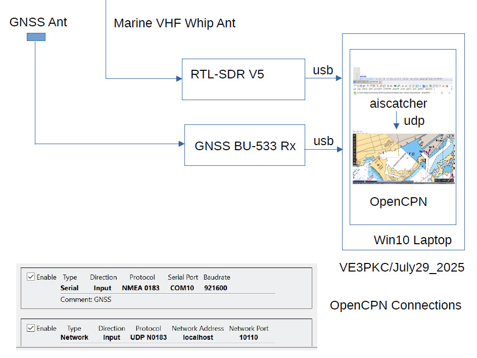
Figure 1 shows the equipment block diagram. This is the same setup I used in Ref.2 . The antenna in this case was a simple 16inch retractable whip.
ENC Charts vs. Paper, RNC_BSB, GEarth
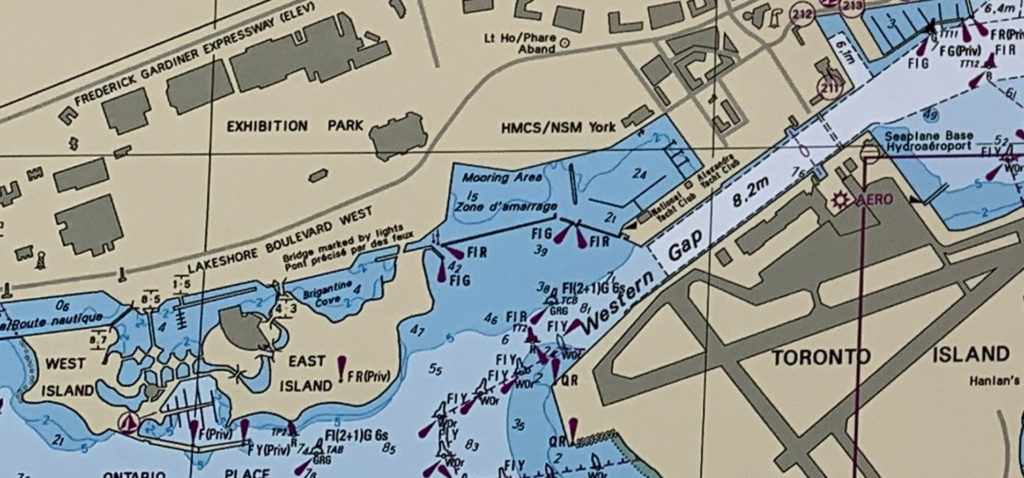
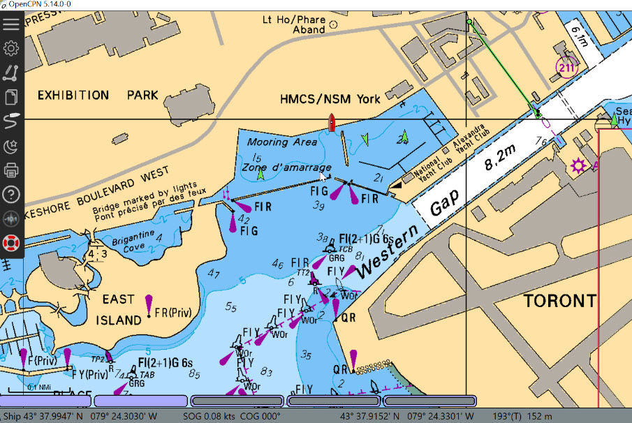
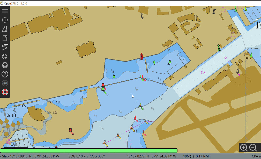
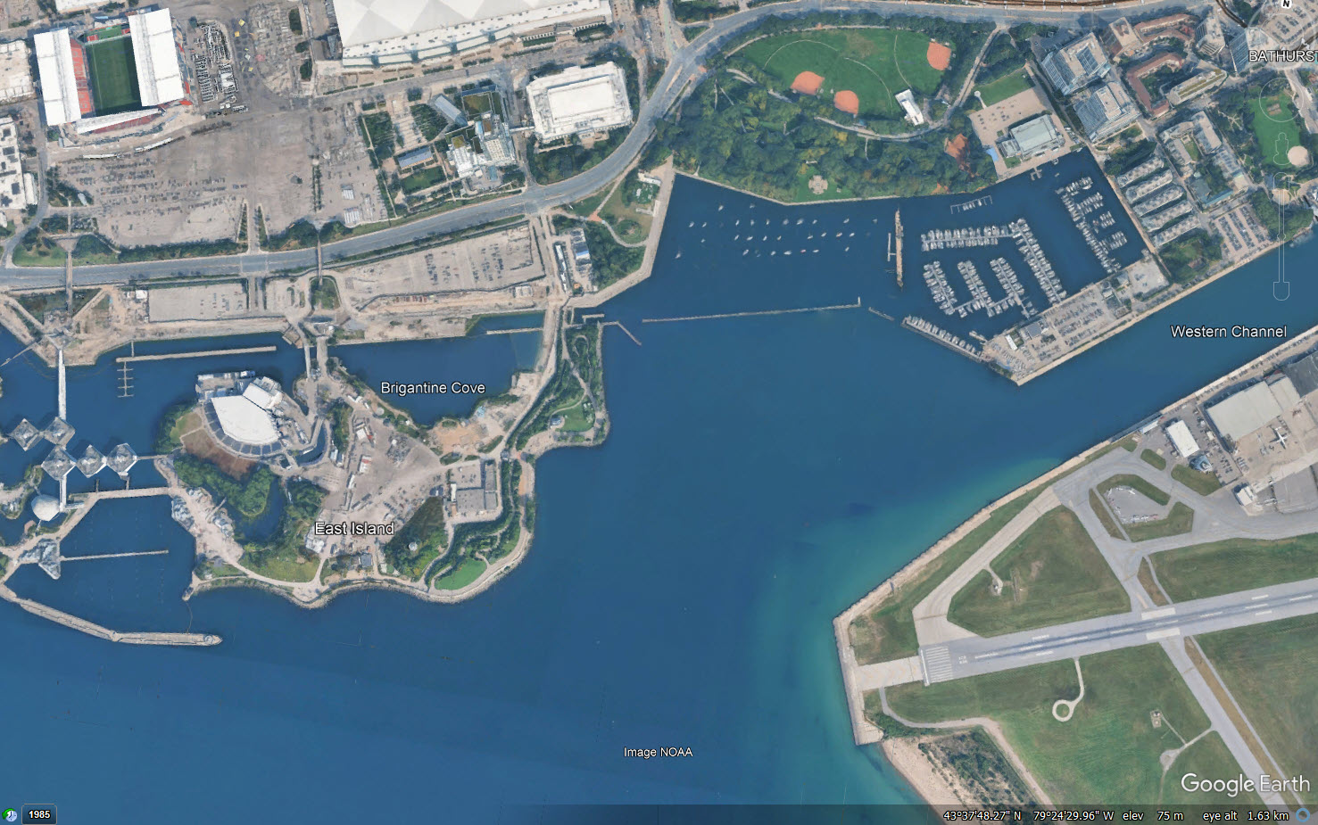
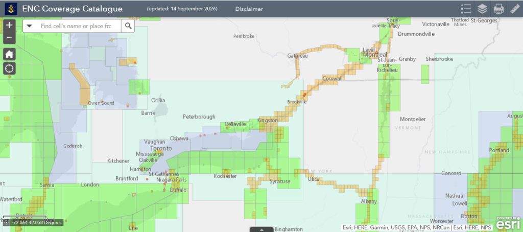
Figure 2 shows the Toronto Harbour as taken from Canadian Nautical Paper chart 2085. Figure 3 shows the Toronto Harbour on Canadian Nautical Raster BSB chart. Notice the raster chart is basically a photograph of the paper chart with no additional data. Figure 4 shows the Toronto Harbour on Canadian Nautical ECN chart. The ECN chart is a vector chart with layers of embedded information. As the chart is zoomed, more information appears and objects can be clicked (Object Query) to bring up descriptions. Ref.3 is a detailed guide to ECN charts. Ref.4 is the Canadian Chart No.1 for Symbols and Abbreviations used in ECNs. Ref.5 allows you to pick an ENC chart anywhere in the World. Figure 6 shows the area between Toronto & Montreal where I checked to verify my charts.
Please send your comments, questions and suggestions to:
contact:

References
#1. – “AIS on OpenCPN ENC Charts”
https://jeremyclark.ca/wp/telecom/ais-on-opencpn-enc-charts/
#2. – “AIS & GNSS on OpenCPN”
https://jeremyclark.ca/wp/telecom/ais-gnss-on-opencpn/
#3. – “Introduction to Electronic Chart Navigation With an Annotated ECDIS Chart No. 1”, 2017, David Burch, ISBN 978-0-914025-57-3
#4. – “Canadian Chart 1 Symbols, Abbreviations & Terms”
https://www.charts.gc.ca/publications/chart1-carte1/index-eng.html
#5. – “IHO On Line ENC Coverage Catalogue”
https://iho.int/en/iho-online-catalogues
