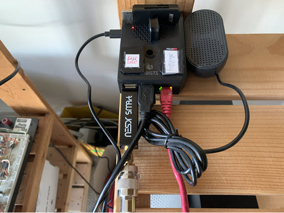
Introduction Every six months or so I like to reload the RPi4B OS to see what changes have occurred. Recently I installed the Debian Trixie 64bit version and am very impressed. All the software that I commonly use installed well with no glitches. I did notice that when using the RTL-SDR and GNSS receiver I… Continue reading Raspberry Pi4B for Air & Marine
Category: Telecommunications
Telecommunications: Propagation, HF, VHF, UHF, uWave
RTL-SDR for Satellite Weather – GOES EAST
Introduction Last week I revisited receiving GOES16 which I had initially done several years ago (Ref.1/7). GOES16 has now been replaced by GOES19 and is also called GOES EAST (Ref.8). I saved the received signal as a baseband IQ file and later decoded with SatDump. In this video I will synchronously receive/decode the signal with… Continue reading RTL-SDR for Satellite Weather – GOES EAST
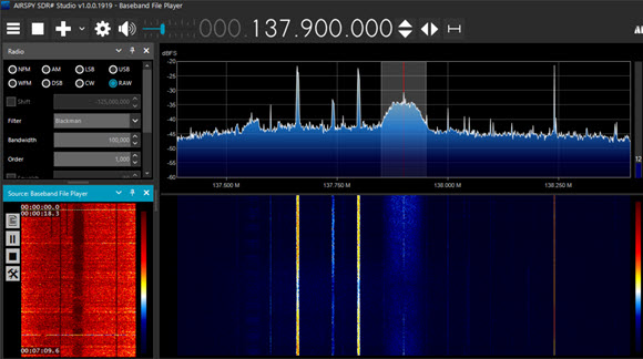
RTL-SDR for VHF Air Band AM Receiver on GNU Radio
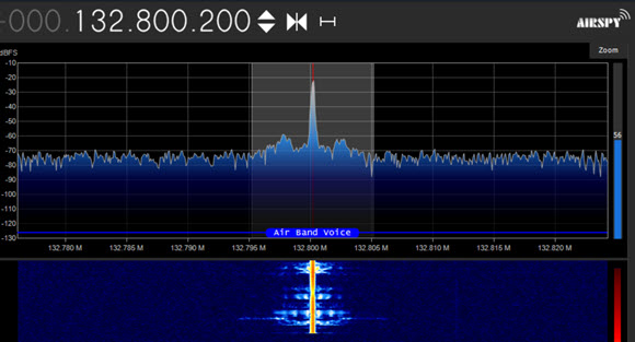
Introduction In a previous post I looked at a simple receiver for VHF Air Band AM (Ref.1). In this post I add several new features in order to select from a stored set of local frequencies and a choice between source blocks. GNU Radio Schematic VHF Air Band AM Receiver Figure 1 shows the GNURC… Continue reading RTL-SDR for VHF Air Band AM Receiver on GNU Radio
RTL-SDR for Satellite Weather – GOES16
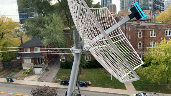
Introduction Four years ago I was able to receive signals from GOES16, a geostationary weather satellite located at 75.2degW (Ref.1/6). I used goestools on RaspberryPi4B. In the last post I decoded signals from Meteor M2-3/4 using SatDump. I noticed that this program also handled GOES. So I setup my dish again and was able to… Continue reading RTL-SDR for Satellite Weather – GOES16
RTL-SDR for Satellite Weather-Meteor M2-3/4
Introduction Recently I received a notice that NOAA15/18/19 transmissions were coming to an end (Ref.1). Over the past several years I have enjoyed monitoring these transmissions (Ref.2). However from reading various Newsgroups, it appeared that satellite weather was still available on the Meteor satellite family M2-3 & M2-4 (Ref.3). So I set about trying to… Continue reading RTL-SDR for Satellite Weather-Meteor M2-3/4